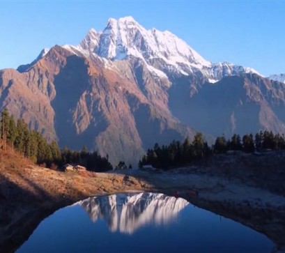
Standing at 6,820 metres (22,375 ft), Cheo Himal is one of Nepal’s quietly formidable expedition peaks. Positioned in the Peri Himal sub-range of Gandaki Province, north of the Manaslu massif, the mountain commands a stark alpine landscape of glaciated ridges and sweeping ice faces.
Overshadowed by its 8,000-metre neighbours, Cheo Himal remains largely off mainstream climbing itineraries a compelling objective for mountaineers seeking technical challenge and relative solitude.
Location and Geographical Context
Cheo Himal lies in Manang District, forming part of the Peri Himal range that borders the Tibetan Plateau. It stands north of the Manaslu region and east of the Annapurna massif within a rugged high-altitude corridor characterised by glaciers, steep rock buttresses and exposed ridgelines.
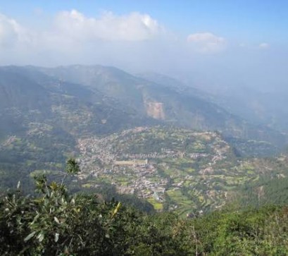
Access is typically gained via the classic Manaslu Circuit, approaching through Besi Sahar and ascending towards the Larke La (5,106m). From the upper Manaslu valley, expeditions diverge towards base camp beneath Cheo Himal’s southern flanks.
Climbing History
Cheo Himal was first successfully ascended on 13 October 1991 by a joint Japanese–Nepalese expedition. The summit team comprised Shigeki Imoto, Ful Bahadur Rai, Dambar Bahadur Gurung and Pasang Tshering Sherpa.
Earlier attempts in 1991 included a British expedition exploring an unclimbed route, during which a Sherpa climber tragically lost his life. These early efforts underscored the mountain’s technical difficulty and objective hazards.
Since its first ascent, Cheo Himal has seen relatively few recorded summits, maintaining its reputation as a serious and infrequently attempted peak.

Cheo Himal Climbing Guide
Peak Classification
Cheo Himal is classified as an expedition peak by Nepal’s Department of Tourism. Unlike trekking peaks managed by the Nepal Mountaineering Association, it requires a full expedition permit.
Technical Difficulty
Cheo Himal involves:
Although below 7,000 metres, the mountain demands solid alpine competence, efficient rope management and careful acclimatisation planning. It is suitable for experienced mountaineers rather than novice climbers.
Standard Route Overview
Most expeditions follow the south or south-east approach:
Route conditions vary significantly depending on seasonal snowfall and glacial movement. Objective risks include avalanche exposure and serac fall.
Best Seasons to Climb
The optimal climbing windows are:
Spring (March-May) - Pre-monsoon clarity with comparatively stable snow conditions.
Autumn (September-October) - Post-monsoon stability and excellent visibility.
Winter brings extreme cold and wind, while the monsoon season presents unstable snow and high avalanche risk.
Permits and Fees
Royalty fees vary by season and team size. Climbers should consult authorised trekking agencies or the Department of Tourism for updated rates, as fees are subject to periodic revision.
Logistics and Approach
Expeditions typically:
The approach itself is a high-mountain journey through remote settlements, yak pastures and glacial valleys.
Physical and Technical Preparation
Climbers should be proficient in:
Given the mountain’s isolation, evacuation logistics are complex, and expedition self-sufficiency is critical.
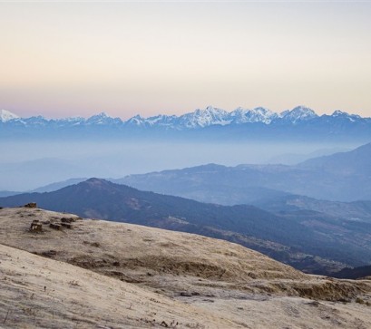
While global attention gravitates towards Mount Everest and the Annapurna massif, Cheo Himal embodies a different Himalayan ethos defined by remoteness, technical integrity and wilderness immersion. It offers experienced climbers a rare opportunity to engage with the Himalaya beyond commercial expedition routes. For trekkers on the Manaslu Circuit, even a distant view of Cheo Himal’s austere silhouette reinforces the raw scale of Nepal’s mountain frontier.
In a nation renowned for its giants, Cheo Himal stands quietly resolute, a sentinel of the Peri Himal range and a testament to Nepal’s enduring mountaineering legacy.
PC: Shutterstock, Adobe Stock
Also Read


.jpg)