Tucked between Gaurishankar—a peak the Sherpa consider among the most sacred in the range—and the Tibetan plateau, the Rolwaling valley runs roughly east to west for about forty kilometers. It is home to fewer than a thousand permanent residents, no roads, and a stillness that feels earned rather than incidental. The valley receives under 3,000 trekkers per year – compared to the 50,000+ in the Everest region.
Most trekkers headed to this part of Nepal turn south toward Jiri, or fly east to Lukla and the Khumbu’s well-worn corridors. The Rolwaling sees a fraction of that foot traffic, partly because the approach from Charikot requires two or three days of walking before the mountains properly reveal themselves, and partly because the classic route—crossing the Tesi Lapcha pass at 5,755 meters into the Khumbu—demands real mountaineering skills and a rope team.
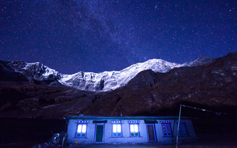
Those who do make the commitment find a valley operating on its own quiet terms. The village of Beding, at around 3,700 meters, consists of perhaps thirty stone houses, a monastery of considerable age, and a social rhythm organized entirely around the movements of the yak herds. The buildings are constructed in the traditional Tibetan influenced style of the high altitude Sherpa communities—thick stone walls, small windows, flat roofs layered with firewood and fodder against the coming winter. Prayer flags stretch between rooftops in all directions, their colours faded by wind and altitude to the soft pastels of old silk. The monastery at Beding is dedicated to Guru Rinpoche and houses a small community of monks whose chanting at dawn drifts across the valley with an intimacy that no speaker system could replicate.
The Sherpa of Rolwaling are called the Beding people—they spend the winter in the lower villages and return each summer to graze yaks on some of the highest permanent pastures in the world.
Above Beding lies Na, the last permanent settlement before the glacier, where wooden prayer flags snap in winds that carry no sounds from anywhere the twenty-first century has reached. Na sits at approximately 4,180 meters and functions as the high-altitude summer grazng base for the valley’s yak-herders. During the warmer months, the meadows around Na fill with the sound of yak bells and the smell of burning juniper (Dhupi). The herders move their animals up from Beding as the snow retreats each spring, following a calendar that has not changed in any essential aspects for centuries. There is a spare functional quality to life at Na – the shelter is basic, the food is filling rather than elaborate, and the schedule is determined by the weather and the animals, not by anything a human being has decided.
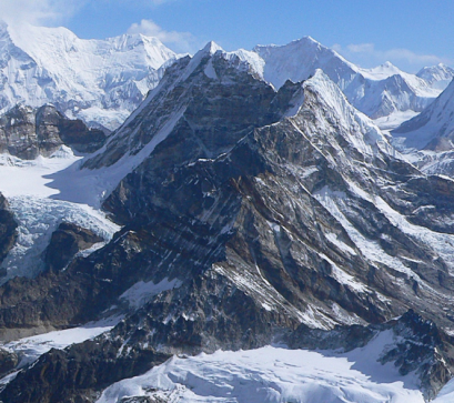
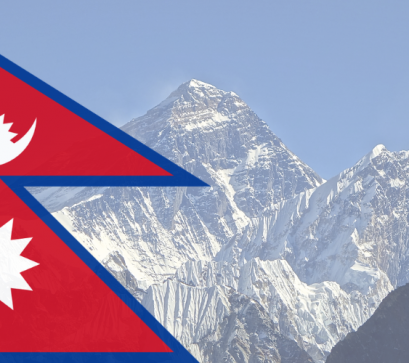
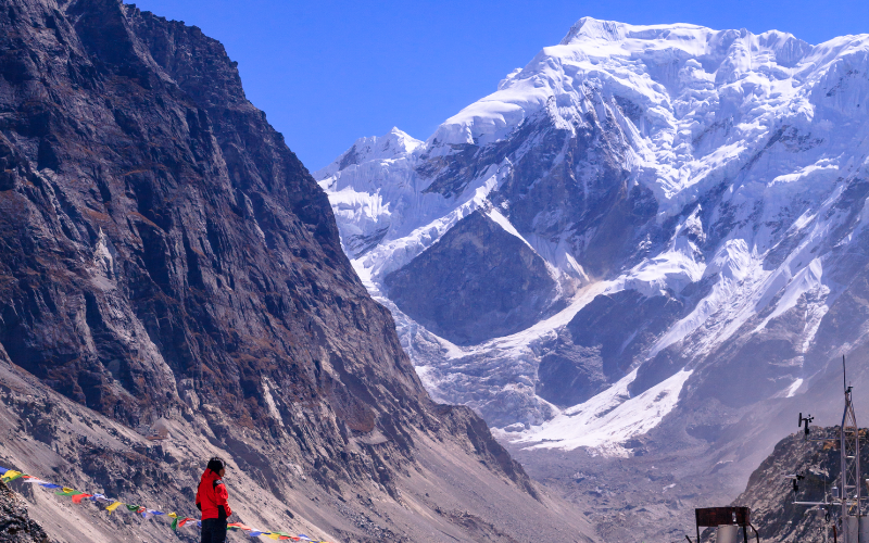
Dominating the eastern end of the valley, Gaurishankar rises to 7,134 meters and was, until precise measurements of Sagarmatha were made in the mid-nineteenth century, believed to be the world’s highest peak. The mountain’s double summit – one peak consecrated to Shiva, and the other to Parvati – gives it its name and explains the reverence with which the communities below regard it. For the Sherpa of Rolwaling, Gaurishankar is not merely a geographical feature but a living presence, a deity whose moods are expressed in the weather that rolls down from its flanks. Offerings are made to the mountain at specific times of the year, and its summit remains off-limits to the casual mountaineer in practice even if not always in permit terms – the cultural weight is enough to deter most.
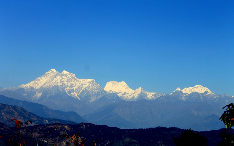
The first successful ascent of Gaurishankar was not achieved until 1979, by a joint American-Nepali team, making it one of the later major Himalayan summits to fall. The difficulty is not merely technical. The mountain’s approaches are long and complex, the weather in this part of the range is notoriously unpredictable, and the gorged terrain above the base camp requires a level of commitment that filters out all but the most serious expeditors. This has been inadvertently, another layer of protection for the valley below – a place that even the mountaineering community tends to look at from a respectful distance.
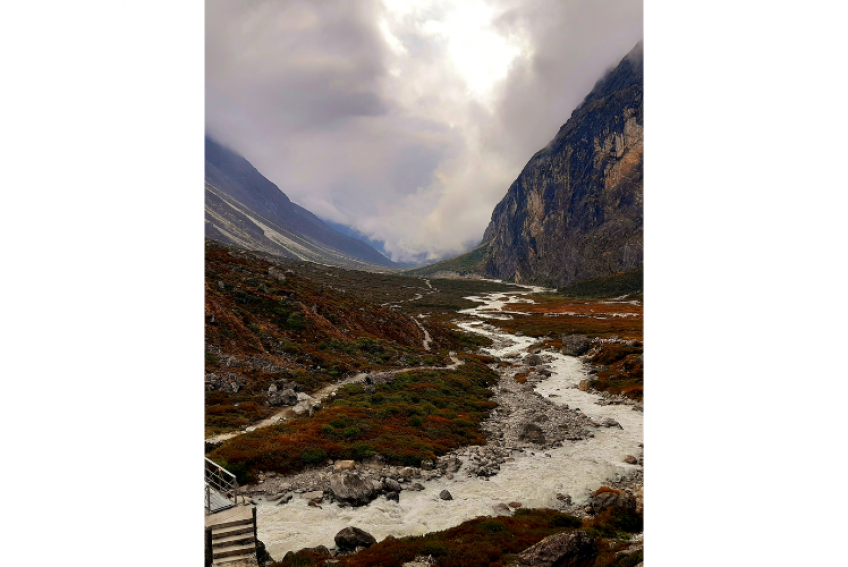
Geologically, Rolwaling is one of the youngest shaped valleys in the range. The Rolwaling Glacier, retreating in visible increments over recent decades, once filled the entire basin; what remains now is a series of glacial lakes—the most striking being Tsho Rolpa, which has now grown substantially as the ice withdraws. Tsho Rolpa sits at 4,580 meters and has expanded more than fivefold in surface area since systematic measurements began in the mid-twentieth century. Its turquoise water, coloured by the fine glacial silt suspended within it, sits against a backdrop of ice and rock that is magnificent and sobering in equal measure.
At Tsho Rolpa, the Nepalese government and international agencies have installed drainage systems and early warning infrastructures to reduce the risks of GLOF (Glacial Lake Outburst Floods).
For a trekker who has acclimatized properly and arrives with the right equipment, the Tesi Lapcha pass at 5,755 meters represents one of the most demanding and rewarding crossings in Nepal. The route from Rolwaling to the Khumbu via Tesi Lapcha is not a simple high-altitude walk. The pass involves fixed rope sections, crampon work on glaciated terrain, and requires a guide familiar with the route’s particular hazards – the glacier approach changes character from season to season as ice shifts and crevasses open. Crossing it in good conditions delivers the trekker into the upper Khumbu above Thame, emerging from one of Nepal’s least-visited valleys directly into one of its most celebrated, the contrast between the two sharpening the appreciation of both. Those who make this crossing tend to describe it as one of the formative experiences of their time in Nepal, not because of any single dramatic moment, but because of the sustained sense of commitment that the route demands and rewards.
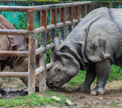
The Gaurishankar Conservation Area, formally established in 2010 to protect the Rolwaling Valley and its surroundings, encompasses approximately 2,179 square kilometers of terrain ranging from subtropical forest in the lower reaches to permanent snow and ice at altitude. The conservation area was created partly in response to concerns about the impact of increasing number of trekkers on the valley’s ecology and partly to formalize protections that the local community had maintained informally for generations. The valleys relative inaccessibility has meant that its wildlife populations are comparatively intact: snow leopard, Himalayan tahr, musk deer, and red panda all inhabit the upper reaches of the conservation area, though sightings require patience and a willingness to move slowly.
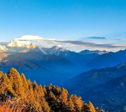
The lower slopes of the valley, below the permanent snowline, are covered in forests of rhododendron, oak, and fir that bloom into spectacular flowers in April and May. The rhododendron bloom is Rolwaling is less famous than the celebrated displays in Everest and Annapurna regions, which means that trekkers who time a spring visit correctly often find themselves walking through corridors of crimson and pink entirely alone – an experience that, in the more traveled zones of Nepal, has become extremely difficult to replicate.
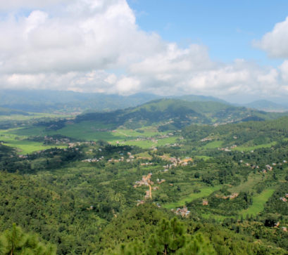
Access begins from Charikot (Dolkha district), reachable by bus from Kathmandu in roughly six hours, though the road conditions in the post-monsoon season can extend this considerably. The trail follows the Tama Koshi river – itself a major glacial waterway with a dramatic gorge in its lower sections – before climbing into the valley proper through a series of lower hill villages where the agriculture transitions from rice and maize to potatoes and buckwheat as altitude increases. A restricted area permit is required for the upper Rolwaling – available in Kathmandu – as teahouses exist only as far as Na; beyond that, camping gear is essential. Trekkers planning the Tesi Lapcha crossing must carry technical equipment and are strongly advised to engage a certified guide with specific experience on the pass. The best seasons mirror the rest of highland Nepal: October through November, when skies are clear and stable, and mid-April through May, when the rhododendrons (Laligurans) bloom and the days are long. The monsoon months of Jume through September are navigable for experienced trekkers but the trails have become dramatically more hazardous and the views largely obscured.
Picture Credits: Wikimedia Commons
Also Read