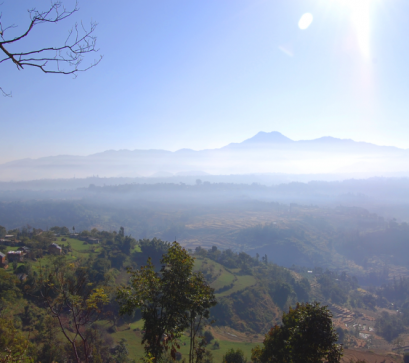
There is a particular geography to Myagdi district that rewards slow attention. It is a district defined by gradient – from the subtropical river valleys of the Myagdi Khola in the south to the high glaciated terrain above the Dhaulagiri massif in the north, the elevation changes are among the most dramatic in Nepal's mountain districts. And sitting somewhere in the middle of that gradient, in a gorge carved by the Kali Gandaki near the confluence with the Myagdi Khola, is Tatopani.
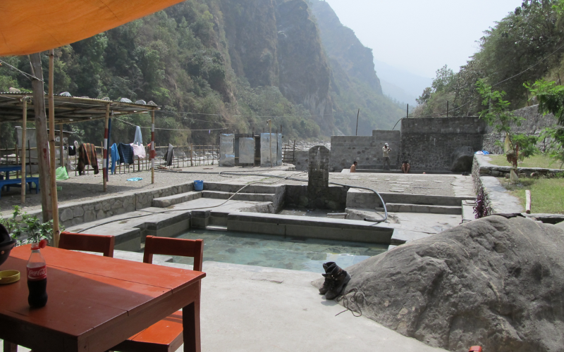
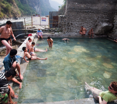
The name means what it says. Tato pani – hot water. Nepal has several settlements carrying this name, a reminder that hydrothermal activity is distributed across the Himalayan geology in ways that continue to surprise. But the Tatopani in Myagdi, lying along the old trade route that once connected the Terai to Mustang and Tibet, has a particular quality of place. The gorge is narrow and the river loud. The springs emerge from the rock at the river's edge, warm enough to sit in without discomfort, producing a thin mineral smell that mixes with woodsmoke from the teahouses and cold air sliding down from the north.
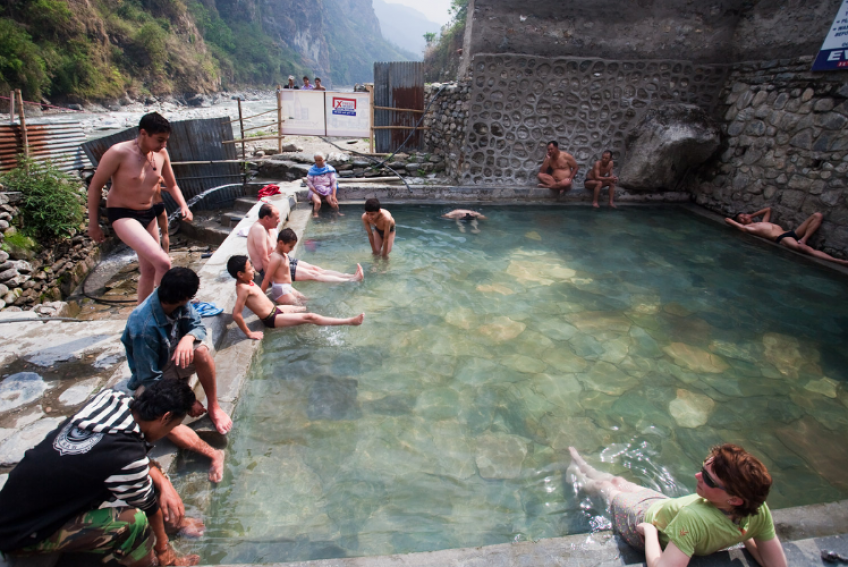
The thermal springs at Tatopani are not a managed spa complex – they are natural, riverbank-level pools and seeps used for bathing and recuperation by travellers, traders, and local residents for as long as anyone here can account for. The water temperature varies by season and by proximity to the main vent points, but consistent heat makes mid-afternoon bathing – particularly after days on the trail – feel genuinely restorative. The geology behind this is Himalayan hydrothermal activity.
Groundwater percolating deep through fractured rock is heated by geothermal sources before emerging at the surface – a process common along the Main Central Thrust zone where the Indian tectonic plate continues its slow collision with Asia. The minerals dissolved in this upward-moving water, sulphur compounds and carbonates among them, produce both the characteristic smell and the therapeutic reputation the springs have carried for generations.
What has changed Tatopani's relationship to the rest of Nepal in recent years is road access. The construction of motorable tracks along the Kali Gandaki corridor – part of the broader push to connect the high mountain districts of Mustang and Dolpa with the lower road network – has brought vehicles where previously only foot traffic and mule trains moved. This is neither a simple gain nor a simple loss.
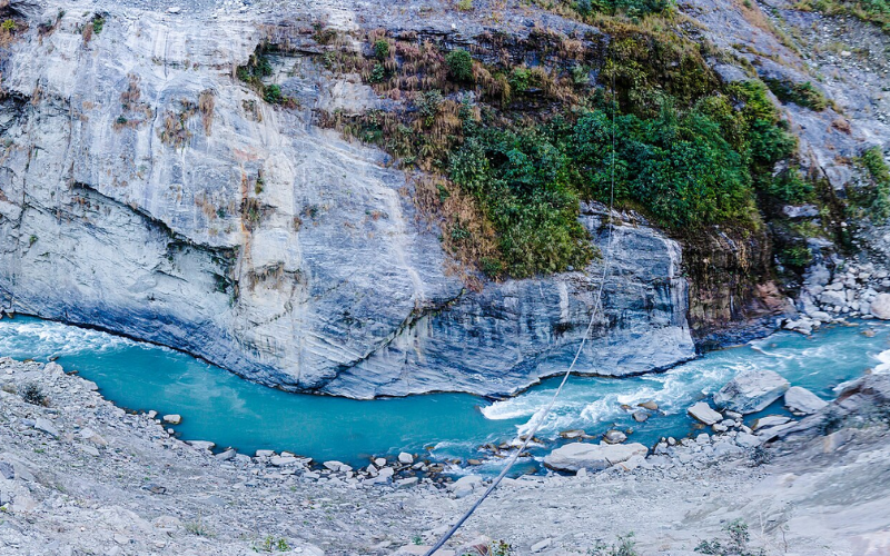
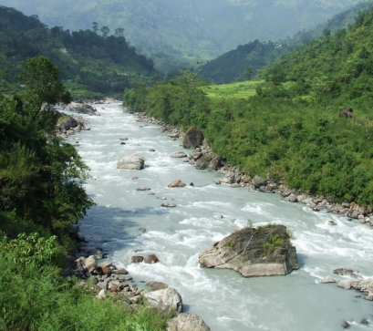
The road north through the Kali Gandaki gorge passes through some of the most geologically arresting terrain in Nepal. The gorge itself is one of the deepest river gorges in the world, with Dhaulagiri to the west and Annapurna to the east forming walls that rise from near-subtropical riverbed to above 8,000 metres within a horizontal distance of roughly 35 kilometres. Ammonite fossils – shaligrams, considered sacred in Hindu and Buddhist traditions – erode out of the riverbeds and cliff faces along this route. Local communities have collected and traded them for generations.
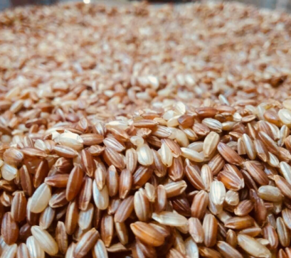
The road follows the same logic as the ancient trade route it partially overlies. Caravans of Tibetan salt, wool, and grain moved south along this corridor for centuries; Tarai rice, lentils, and goods moved north. The opening of the China-Nepal border altered the economics of this exchange and Tibetan salt largely disappeared from Nepali markets, but the corridor remains animated with movement – now of vehicles, trekkers, and traders dealing in medicinal herbs, wool, and the domestic tourism that has followed road access.
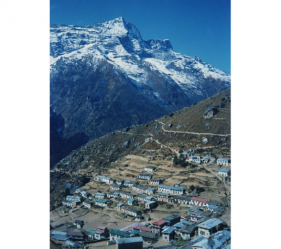
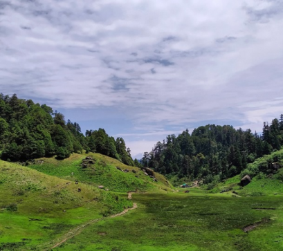
Above Tatopani, the Kali Gandaki corridor continues northward through Ghasa, Marpha, and Jomsom into Upper Mustang. But for those whose attention turns west, the Myagdi side valleys open into different terrain entirely – the high-altitude flanks of the Dhaulagiri range, where glaciers feed the headwaters of the Myagdi Khola.
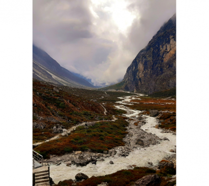
The Dhaulagiri massif carries multiple glaciers on its southern and southwestern aspects, draining into the Myagdi river system. These are not tourist-facing glaciers in the manner of Khumbu or Langtang – they sit at the end of routes requiring genuine mountaineering commitment and proper permitting. But their presence shapes the valley in ways visible even from lower elevations: the particular milk-blue colour of glacier-fed tributary streams meeting the clearer Kali Gandaki water; the debris moraines visible from the trail; the cold air that descends in late afternoon regardless of season.
For the traveller at Tatopani, this convergence – warmth rising from the earth through hydrothermal vents, cold descending from glaciers above – is not merely picturesque. It is a compressed lesson in the physical geography of the Himalayas: the way tectonic collision, erosion, and climate have stacked entirely different worlds within a single day's walk of altitude.